Key findings
- There is an interdependency between phosphorus levels and chlorophyll-a concentrations in the Thames basin, but the relationship is highly complex.
- Water flows are projected to decrease in the Thames basin under future climatic conditions, whilst light is the dominant factor limiting algal bloom development in all projected future climatic and land use storylines.
- To limit algal blooms under future climatic changes, water management should maintain river flows where possible, and keep river channels in the upper catchment cool through riparian vegetation planting.
Water management issues
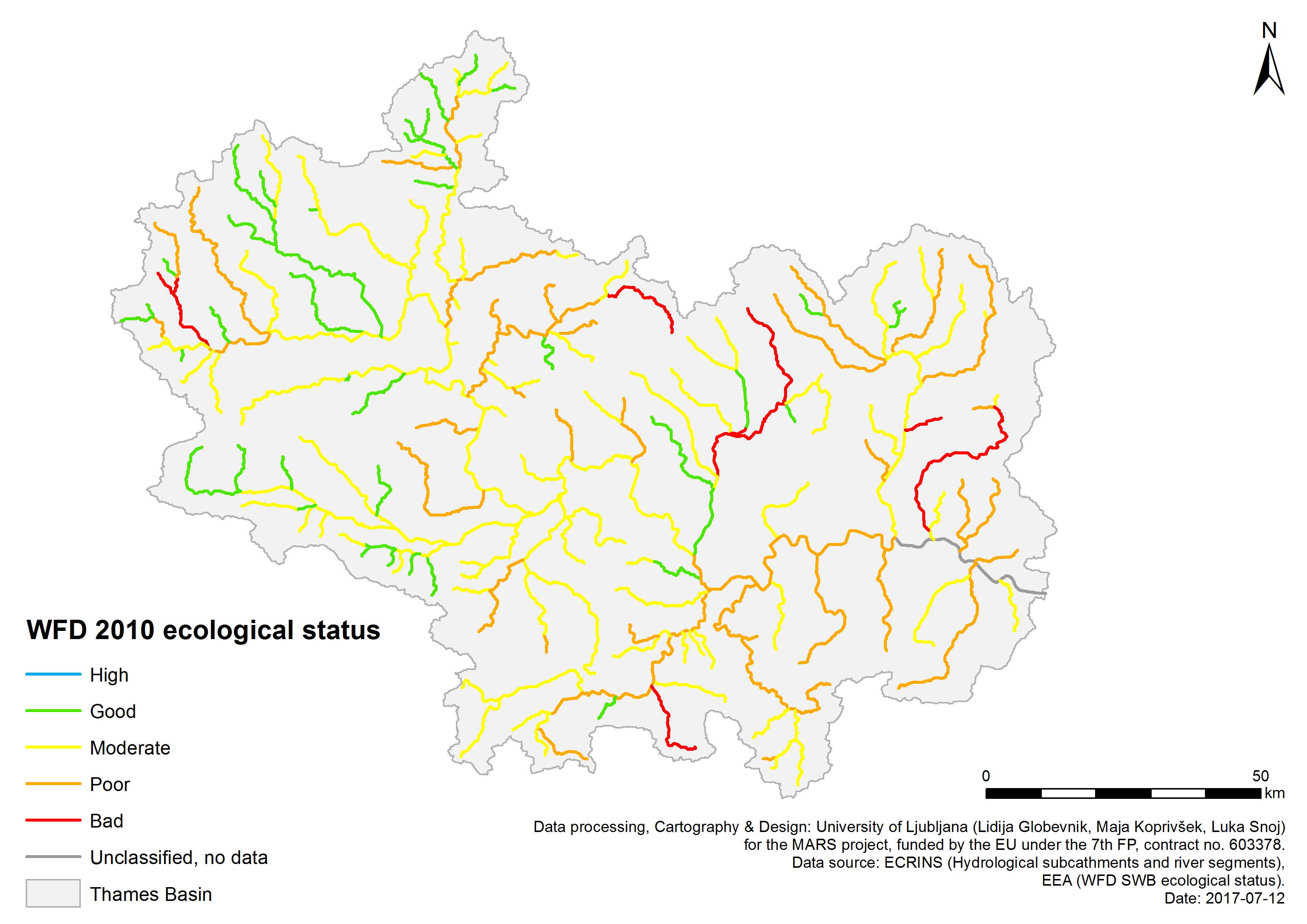
According to the 2015 River Basin Management Plan assessment, only 39 of the 498 surface waters surveyed by the Environment Agency in the Thames basin are at good ecological status or potential. The majority are rated as moderate (320), with 112 poor and 27 bad. Around half (25 water bodies) of the 47 groundwaters sampled are at good quantitative status (i.e. water quantity) and 29 are at good chemical status.
Two key aquatic ecosystem services in the Thames basin are public water supplies and recreational activities such as fishing, boating and bathing. There are many pressures affecting the ecological status and service provision of Thames basin rivers, lakes and groundwater.
Growing urban areas and transport systems cause demands for abstraction (including from groundwater aquifers) for water supplies, and increased pollution discharges into freshwaters: both point-source (e.g. nutrient- and bacteria-rich sewage plant discharges) and diffuse (e.g. urban run-off of chemicals and sediments). The hydromorphology of rivers in urban areas (particularly in the Thames in London) has been widely altered by urban growth, flood protection and the construction of weirs. Ongoing climatic changes are predicted to cause increasing hydrological stresses in the future due to changes in rainfall and evaporation patterns.
Intensive arable agriculture can cause diffuse pollution of nitrates, phosphorous and pesticides into aquatic systems, increase demands for water abstraction for irrigation, increase sedimentation, and physically modify riparian zones to alter land drainage. The Thames basin is increasingly impacted by non-native invasive species such as the signal crayfish, can which outcompete native species for food and habitat.
Environmental storylines and scenarios
The MARS modelling work in the Thames basin used a suite of process-based environmental models to produce groundwater and river flow, and river and reservoir water quality predictions under three future ‘storyline’ scenarios. The research generated projected ecological responses to pairs of stressors comprising extremes in water temperature, flow rate and nutrient availability.
Three different storylines (Techno, Consensus and Fragmented World) are used by MARS to forecast potential trajectories for future European environments. The MARS scenarios forecast environmental changes in the context of three storylines describing future political, economic, social and climatic changes. Each scenario incorporates a different climate model based on Representative Concentration Pathways 4.5 and 8.5, and was modelled to ten year periods around 2030 (to inform the WFD) and 2060 (to observe climatic changes).
Each scenario was tailored to the Thames basin through projected changes to land use, abstraction rates, shading and urbanisation. Fragmented World frames a global situation where countries have little regard for environmental protection. In the Thames basin, urban areas increase by 50% compared to the present day, arable agriculture is reduced by 30%, abstraction increases by 25%, phosphorous loading is high, and climate change is significant (RCP 8.5). In Techno World, economic growth is prioritised and environmental management is typically ad hoc, and focused on instrumental gains such as flood and drought protection. In the Thames basin, urban areas increase by 50% compared to the present day, arable agriculture is reduced by 10%, abstraction decreases by 10%, phosphorous loading is moderate, and climate change is significant (RCP 8.5).
Consensus World simulates economic growth and environmental protections similar to the present day. In the Thames basin, urban areas increase by 20% compared to the present day, arable agriculture remains constant, abstraction is reduced by 20%, phosphorous loading is high, and climate change is moderate (RCP 4.5). Whilst each scenario is a broad-scale approximation, their use in modelling provides a range of possible future trajectories to inform management and policy decisions.
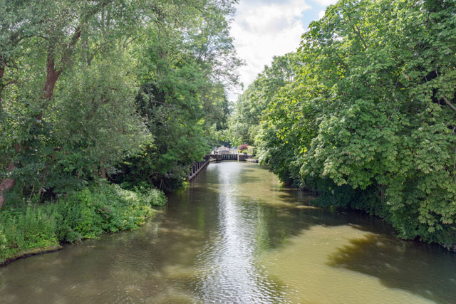
The River Thames at Pangbourne in Surrey

Farmoor reservoir, Oxfordshire, April 2011

River Thames near Wargrave, UK
Results and conclusions
Multi-stressor interactions
There is an interdependency between phosphorus levels and chlorophyll-a concentrations in the Thames basin, but the relationship is highly complex when decay and recycling of phosphorous starts to occur.
Chlorophyll-a concentrations respond swiftly to environmental factors, on an hourly scale, demonstrating the complexity of the Thames system. This dynamic is difficult to capture in a multi-site, multi-year empirical modelling process. Process modelling demonstrates that algal biomass, shading and residence time (flow) are key sensitive stressors.
Scenario Analysis
Light is the dominant factor limiting algal bloom development in all storylines. For example, implementing river channel shading to 40% as defined under Consensus World is very effective at preventing accelerated algal growth, particularly in downstream reaches.
Consensus World differs from the other storylines and the present day baseline in that algal blooms are also strongly limited by phosphorus.
In the Fragmented and Techno World storylines phosphorus supply is higher and algal growth continues unconstrained to very high levels.
Only under the Consensus World is the quality of the Farmoor reservoir is projected to improve due to less nutrient rich river influent, with severe deterioration found under the Fragmented (and to a lesser extent, under the Techno) World which would have damaging consequences to drinking water supply in the basin.
Water flows are projected to decrease in the Thames basin under future climatic conditions. This hydrological change is apparent for all climate models and is a trend that is pervasive along the river system. Changes in low flows in the summer growing season exacerbate any trends in increasing water temperature which may be brought about solely by an increase in air temperature. Higher water temperature leads to a decrease in dissolved oxygen although this is only substantial downstream (at TC18) by which point there may be impacts from eutrophication.
There is a consistent general pattern of deterioration of the water quality in the Farmoor reservoir across all three storylines between the earlier period (2030s) and the later period (2060s), attributed to an increase in temperature. Regardless of storyline, cyanobacteria biomass changes tended to be relatively greater then total chlorophyll changes, the difference increasing later in the century, also attributed to warmer conditions.
Significance for water management
The results suggest that only by implementing radical changes in the management of the Thames basin can the Techno World and Fragmented World scenarios support a sustainable catchment.
Whilst the complex dynamics of algal blooms in the Thames cannot be adequately represented using empirical modelling at the annual scale, blooms are more likely under low flow conditions with increased water temperatures. As such, the MARS study advises that water management should maintain river flows where possible, and keep river channels in the upper catchment cool, through riparian vegetation planting.
The Thames is not nutrient limited, there is little need to keep phosphorous levels low, although in upstream reaches this would probably be beneficial. There is some evidence that low phosphorous levels further down the river system may actually be detrimental to river health. Reduction of nutrients in rivers could help reduce the total phytoplankton biomass in reservoirs, but this might be mitigated by an increase in the dominance of that biomass by the toxic cyanobacteria species as the century progresses and becomes warmer.
The most extreme climatic changes might result in drying of the river part of the year which could only be mitigated with drastic changes in water management through building a new reservoir or water transfer from outside the catchment. They would be associated with severe deterioration of the water quality both in the river and the existing reservoir.
Basin overview
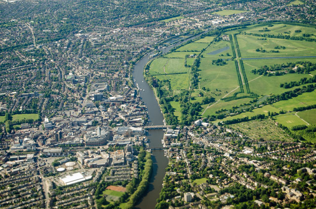
The River Thames is the second longest river in the UK, covering 354km between its source in the Cotswold Hills and its tidal limit at Teddington Lock in south-west London. The Thames catchment covers an area of 9948 km2, housing a fifth of the UK population and containing major urban centres of London, Swindon, Oxford, Slough and Reading. The eastern and northern parts of the Thames basin are heavily urbanised, whilst the western regions are predominantly rural and dominated by arable agriculture. The basin is predominantly underlain by Cretaceous Chalk geology, with Oolitic Limestones in the upper catchment. The basin is one of the driest in the UK, with rainfall below national average, yet supplies over two-thirds of London’s drinking water, of which around 40% comes from chalk aquifer groundwater stores.
Context for modelling
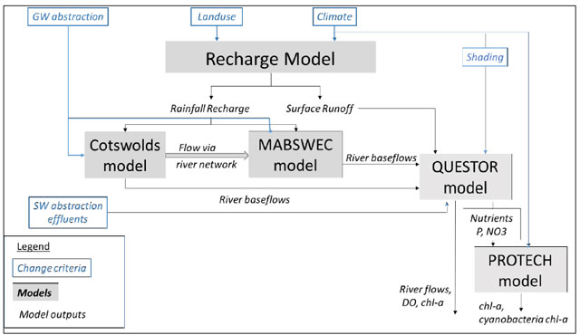
Three models were used to simulate groundwater and river flows in the complex hydrogeological system of the upper and middle reaches of the Thames basin: gridded recharge models (for rainfall recharge), the Cotswold model (for groundwater level and flows), and the MABSWEC model (a groundwater model). All three models were run for the period January 2009 – December 2012 for calibration against observed data.
River water quality modelling for the Thames used the QUESTOR model, which generated outcomes at Eynsham (upper reach) and Wallingford (middle reach). Reservoir water quality modelling was undertaken using the PROTECH model to simulate phytoplankton abundance in the Farmoor reservoir near Oxford.
Following the MARS Cookbook approaches for modelling multiple stressor interactions, a Generalised Linear Mixed Modelling with two stressors (including temperature, flows and nutrient levels) was undertaken to answer each research question using site and year as random effects.
The models were brought together in a DPSIR (Driver, Pressure, State, Impact, Response) framework to simulate abiotic and biotic state and ecosystem service provision under the different scenarios for environmental change.
Materials and methods
The Thames basin is monitored by a dense network of hydroclimatic, chemistry and biotic gauges, which provided environmental data for use in modelling.
Facts and Figures: THAMES
Further reading
MARS Deliverables:
MARS (2017). Case study Thames- Case Study Synthesis - Deliverable 4.1. (Download report, 26.1mb)
Scientific articles and reports:
Environment Agency (2009). River Basin Management Plan Thames River Basin District (External website).
Environment Agency (2015). Part 1: Thames river basin district River Basin Management Plan (External website).Websites:




Thames-Basin.jpg)
