Key findings
- Climate change is projected to increase air temperatures and transpiration rates in the Odense basin in the 21st century.
- River discharge is the main driver of organic nutrient loads, and discharge variations were largely driven by climate inputs; whilst land use change (via agricultural fertiliser inputs) and river discharge are key drivers of inorganic nitrogen loads.
- Water management should prioritise measures which reduce nutrient loading from land use under future climate change.

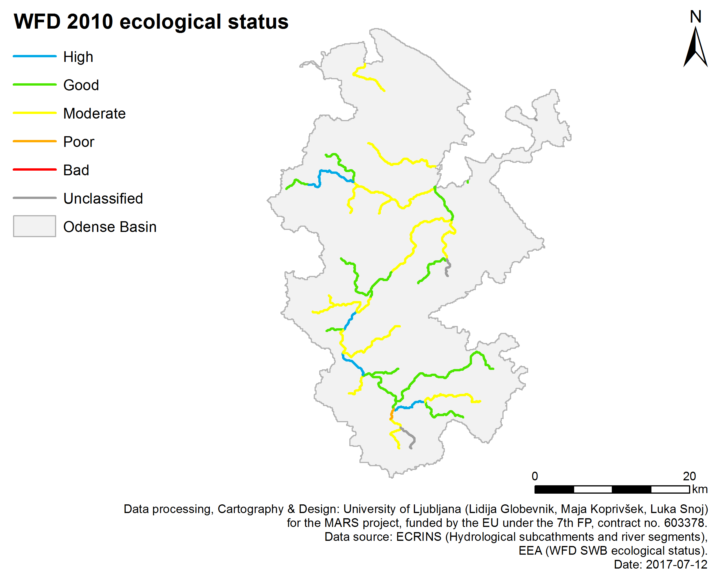
Odense WFD status 2010
Water management issues
In the Odense basin, 39% of streams are classified as having ‘good’ or ‘high’ ecological status by Water Framework Directive monitoring. Reasons for poor ecological status include waste water from dwellings not connected to sewer networks, diffuse pollution of agricultural pesticides, land drainage, groundwater abstraction and hydromorphological alterations including culverting, channelisation and channel widening and deepening.
Only 19% of the lakes in the Odense basin are classified as ‘good’ or ‘high’ ecological status. Poor ecological status is largely the result of eutrophication caused by nutrient pollution, predominantly of phosphorous. Similarly, the Odense estuary is classified as ‘poor’ ecological status, largely due to eutrophication caused by nutrient loading. The key ecosystem services in the basin are water supply, nutrient retention, recreation and angling.

Fragmented World characterized by increasing fertiliser application
Agricultural areas remain similar in Techno World
Environmental storylines and scenarios
The MARS study in the Odense basin sought to understand the links between climate, catchment processes and biological responses in both freshwater and estuarine ecosystems. The study modelled different scenarios of future climate, land use and management changes to evaluate the ecological effects of multiple stressors, including nutrient loading, temperature increases and alterations in water flow dynamics. The MARS scenarios forecast environmental changes in the context of three storylines describing future political, economic, social and climatic changes, modelled for ten year periods around both 2030 (to support the WFD) and 2060 (to show the impacts of climate change). Each scenario incorporates a different climate model based on Representative Concentration Pathways 4.5 and 8.5.
Each scenario was tailored to the Odense basin through projected changes to agricultural land use. Fragmented World) frames a global situation where countries have little regard for environmental protection. In the Odense basin the agricultural area increases and changes towards intensive pig and dairy farm types. Livestock density and fertiliser application increase, and climate change is significant (RCP 8.5). Consensus World has economic growth and environmental protections similar to present day. In the Odense basin, the agricultural area decreases and changes towards forest and less intensive farming types. Artificial fertiliser application decreases slightly, and climate change is moderate (RCP 4.5).
In Techno World, economic growth is prioritised and environmental management is typically ad hoc, and focused on instrumental gains such as flood and drought protection. In the Odense basin the agricultural area remains similar, with some conversion to permanent grass and willow. There is a slight increase in livestock density and slight decrease in artificial fertiliser application rates, and climate change is significant (RCP 8.5). Whilst each scenario is a broad-scale approximation, their use in modelling provides a range of possible future trajectories to inform management and policy decisions. In addition to these scenarios, a baseline for the period 2001-2010 was modelled for reference and validation.
Fishing in the Odense river

Odense river in an urban area
Results and conclusions
Findings of scenario analysis
Transpiration rates increase in all the scenarios, following patterns of increasing temperatures over time. The use of different models altered projections of future water flows, which decrease in all scenarios in the GFLD model; but increase in Techno and Fragmented worlds, and stay the same in Consensus world, in the IPSL model. Groundwater remained the dominant water flow component, increasing in the Techno and Consensus worlds, and decreasing in the Fragmented world.
Multi-stressor interactions
River discharge was the main driver of organic nutrient loads, and discharge variations were largely driven by climate inputs. Inorganic phosphorous levels showed a similar pattern to those in groundwater flow. Isolated land use change effects on nutrient loads were most evident in altered nitrate concentrations as a result of fertilisation changes. Both land use change (via fertiliser inputs) and river discharge were key drivers of inorganic nitrogen load. Agricultural fertilisation had a strong influence and inorganic nitrogen loads decreased in most of the scenarios with lower fertiliser inputs (Techno and Consensus), and increased in those with higher inputs (Fragmented).
The analysis of nutrient loads becomes more complex when climate change and land use effects are combined. Both nitrogen and phosphorous followed a similar pattern, in which their concentrations varied with total water flows, and can thus be related to variations in in-stream sediment dynamics. Nitrate loads were determined by combined land use and climate effects. For example, in the Fragmented World scenario around 2060, nitrate loads remained constant despite fertilisation increases, due to the decreases in water flow. On the other hand, in the Techno world scenario around 2060, despite fertilisation decreases, nitrate loads increased slightly, due to a rise in total discharge. The choice of climate model therefore important in predicting future nitrate loadings. The IPSL model was seen to best represent the future behaviour of climate in Denmark.
The combined effects of land use and climate change were modelled on four ecological quality indicators under the three scenarios, to give indications of their potential ecosystem impacts. Three indices, the Danish fish index, the Danish macroinvertebrate index, and Average Score Per Taxon (ASPT) responded only slightly to combined land use and climate changes. A larger, and negative, effect of combined land use change and climate change was observed for the macrophyte (aquatic plant) index, in the Consensus World scenario. This was due to an increase in the duration of high flows resulting from the climate change altering aquatic habitats for vegetation.
Significance for water management
NO3- is the main nitrogen fraction in the Odense catchment, and both stressors – land use change (via inputs of fertiliser) and climate change – influence its transport. Although previous studies have predicted a future increase of nitrogen loads, the MARS results show that they will ultimately depend on future catchment land use and management. This is of utmost importance in Denmark, where a reduction of nitrogen loads (70% originating from agriculture) is needed to meet with the WFD objectives. The results, however, must be taken with some caution due to a number of uncertainties. Especially, the analysis revealed that using different concentration pathways has a strong influence on nutrient load results.

River basin Odense
Basin overview
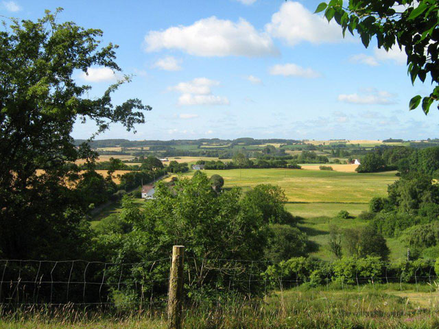
The Odense River basin is a lowland catchment on the island of Funen in Eastern Denmark, which drains into the Odense fjord. The basin is 1061 km2 in extent, and is dominated by agricultural land uses (68% of area), both arable and livestock. Its soils are largely clay and sand, deposited by glacial moraine, which are well-suited to arable cultivation, and the dominant crop is cereals. The basin has a population of around 246,000 people, of which approximately 182,000 live in Odense, Denmark's third largest city. Around 10% of this population live in settlements with no mains sewers. Around 55% of the basin has been artificially modified for drainage in the past century, and around 72% of the major areas of meadow and bog/fen/swamp forest have been destroyed in the same period. Much of this area has been turned into farmland through regulation and alteration of water bodies.

DPSIR model for the Odense Basin
Context for modelling
The study links a process-based hydrological catchment model to empirically developed ecological models. Two climate models – GFLD-ESM2M and IPSL-CMA-LR – were used to model maximum and minimum air temperature, precipitation, solar radiation, relative humidity and wind speed to 2065. The IPSL-CMA-LR model was chosen as most representative of the future Danish climate, and its outputs of daily water flow and nutrient transport (linked to the scenario three simulations) were extracted for use in empirical abiotic-biotic models. The empirical models use four ecological quality indices – Danish fish index, the Danish macroinvertebrate index, Average Score Per Taxon (ASPT), and macrophyte index – to simulate the effects of climate and land use changes on aquatic ecosystems. The models contribute to a DPSIR (drivers, pressures, state, impact, response) model for the Odense basin, in which the effects of different management interventions on ecosystem status and services (water purification, fisheries and recreation) is conceptualised.
Materials and methods
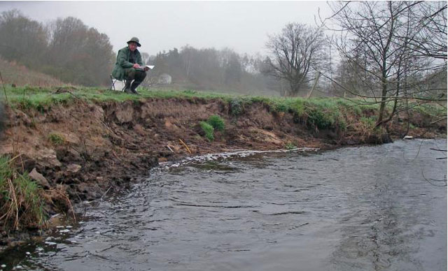
National ecological data sampled between 2004-2012 was used for developing empirical abiotic-biotic models: fish (100 sites, species level), macroinvertebrates (130 sites, species level), stream macrophytes (100 sites, species level). Catchment hydrological data was gathered from 13 fixed gauging stations within the catchment, the oldest yielding nearly 100 years of data; and 100 other stations with instantaneous discharge measurements. Catchment morphological data came from 13 stream stations in surveillance monitoring plus over 100 stream stations in operational monitoring. Catchment physico-chemical data was gathered from 13 fixed gauging stations and discrete sampling of water quality at around 100 other stations.
Facts and Figures: ODENSE
Further reading
MARS Deliverables:
MARS (2017) Case study Odense - Case Study Synthesis - Deliverable 4.1. (Download report, 26.1mb)
Scientific articles and reports:
Environment Centre Odense (2007). Odense Pilot River Basin. Pilot project for river basin management planning. Water Framework Directive Article 13. Layman’s report. Danish Ministry of the Environment – Environment Centre Odense, 12 pp. (Download report, 3mb)
Kronvang, B., Andersen, H.E., Larsen, S.E., & Audet, J. (2013). Importance of bank erosion for sediment input, storages and export at the catchment scale. Journal of Soils and Sediments, 13, 230-241. DOI: 10.1007/s11368-012-0597-7 (Read abstract)
Lu, S., Kronvang, B., Audet, J., Trolle, D., Andersen, H.E., Thodsen, H., & van Griensven, A. (2015). Modelling sediment and total phosphorus export from a lowland catchment: comparing sediment routing methods. Hydrological Processes, 29(2), 280–294. DOI: 10.1002/hyp.10149 (Read abstract)
Lu, S., Andersen, H.E., Thodsen, H., Rubæk, G.H., & Trolle, D. (2016). Extended SWAT model for dissolved reactive phosphorus transport in tile-drained fields and catchments. Agricultural Water Management, 175, 78-90. DOI: 10.1016/j.agwat.2015.12.008 (Read abstract)
Thodsen, H., Andersen, H.E., Blicher-Mathiesen, G., & Trolle, D. (2015). The combined effects of fertilizer reduction on high risk areas and increased fertilization on low risk areas, investigated using the SWAT model for a Danish catchment. Acta Agriculturae Scandinavica. Section B. Soil and Plant Science, 65, 217-227. DOI: 10.1080/09064710.2015.1010564 (Read abstract)
Websites:
Ministry of Environment and Food of Denmark - Pilot project Odense Fjord River Basin (External website)
Freshwaterblog (2014) MARS Experiments: Low Flows in Nordic Rivers (External website)