Key findings
- River flows in the Väike Emajõgi are projected to be significantly lower in the 2030-2060 period compared to the present day, particularly in spring and autumn, as a result of climate change.
- Dissolved inorganic carbon concentrations in Lake Võrtsjärv are projected to be higher in the 2030-2060 period than in the present day, as a result of decreased river flows, causing cyanobacteria bio-mass to increase and protozooplankton biomass to decrease.
- Climate models project an increase in both precipitation and runoff around 2030, compared to the present day, and a subsequent decrease around 2060.
- Water management should minimise water abstraction and diversion pressures in the Võrtsjärv catchment, to maximise ecosystem resilience to future climate change.
Water management issues
Lake Võrtsjärv’s ecological status under Water Framework Directive classification may be between high and moderate, depending on the index chosen. When assessed using planktonic or macrophyte-related indicators, its status is only moderate, because of persistent cyanobacteria blooms and food web alterations caused by high phosphorous and nitrogen concentrations caused by diffuse pollution from agriculture. However, hydromorphology, macroinvertebrate abundance and fish composition indicators give a more positive status indication.
As a result, the key pressures on Lake Võrtsjärv are diffuse nutrient pollution and hydrological alterations, largely driven by agriculture and climate change, which cause persistent eutrophication and cyanobacteria blooms. This can both reduce ecosystem health and status, and limit the provision of ecosystem services including drinking water and recreational activities such as boating and fishing.
Environmental storylines and scenarios
The MARS study on Lake Võrtsjärv sought to forecast the combined influence of climate change, land use and water abstraction on the phytoplankton (cyanobacteria) and zooplankton (rotifer) biomass of the lake in the mid-21st century (2030-2060). The study modelled different scenarios of future climate, land use and management changes to evaluate their ecological impacts. The MARS scenarios forecast environmental changes in the context of three storylines describing future political, economic, social and climatic changes. Each scenario incorporates a different climate model based on Representative Concentration Pathways 4.5 and 8.5.
Each scenario was tailored to Lake Võrtsjärv through projected changes to agricultural land area and water abstraction. Fragmented World frames a global situation where countries have little regard for environmental protection. In the Võrtsjärv catchment, water abstraction is high, forested areas are widely cleared for agriculture, and climate change is significant (RCP 8.5). In Techno World, economic growth is prioritised and environmental management is typically ad hoc, and focused on instrumental gains such as flood and drought protection. In the Võrtsjärv catchment, agricultural expansion and water abstraction increases are moderate, and climate change is significant (RCP 8.5). Consensus World simulates economic growth and environmental protections similar to the present day. In the Võrtsjärv catchment, there is a very small increase in agricultural area and water abstraction, and climate change is moderate (RCP 4.5).Whilst each scenario is a broad-scale approximation, their use in modelling provides a range of possible future trajectories to inform management and policy decisions.

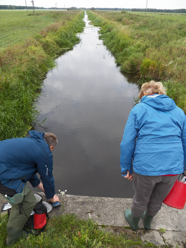
River Väike Emajõgi in southern Estonia that drains into Lake Võrtsjärv (Geonarva|CC BY-SA 3.0 )
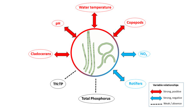
Ecological relationships in Lake Võrtsjärv

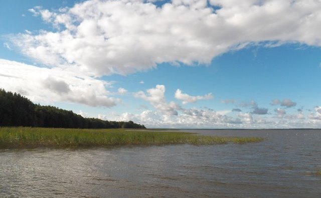
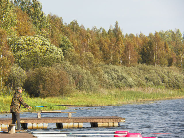
The area surrounding Lake Võrtsjärv is dominated by agriculture and forests
Results and conclusions
Findings of scenario analysis
River flows in the Väike Emajõgi are projected to be significantly lower in the 2030-2060 period compared to the present day, in all modelled scenarios. Compared to the present day, flow decreases are projected to be greatest in spring and autumn months. Model choice influenced the results: simulations using the IPSL model predicted lower flow than those using the GFDL model. For each model, mean flows were higher for the Consensus scenarios, than Techno or Fragmented scenarios. Fragmented scenarios had lower mean flows than Techno scenarios, likely to be the result of greater water abstraction and lower water retention rates in agricultural soils.
Dissolved inorganic carbon concentrations – which help maintain cyanobacteria dominance in the lake – are projected to be higher in the 2030-2060 period than in the present day, in all scenarios. Increases ranged from three-fold for the Consensus scenarios, to six-fold for the Fragmented scenarios. Concentrations are related to discharge: when river flows are low, dissolved inorganic carbon is concentrated in the water column.
Projected chlorophyll a concentrations differed between climate models. Where GFDL predicted no significant changes, IPSL projected significantly higher concentrations for Techno and Fragmented scenarios, particularly in late winter and spring months. Conversely, chlorophyll a concentrations in the IPSL model are projected to be lower in late summer and early autumn months. Similarly, cyanobacteria biomass is projected to increase under all scenarios in the future, with similar monthly dynamics to chlorophyll a: increasing in late winter and early spring, and decreasing in late autumn. These monthly trends are consistent with projected decreases in river flow in the same parts of the year. Rotifer biomass is predicted to significantly decline below present day values in all scenarios, with the spring peak in biomass projected to disappear in coming decades.
Multi-stressor interactions
The main multiple stressor interactions are between those caused by agricultural land use (primarily water abstraction) and those caused by climate change (primarily increased air temperatures and reduced precipitation). The resulting reductions in projected river flow in the future impact on all the biological indicators modelled for the Võrtsjärv lake ecosystem.
Significance for water management
The study suggests that river flows in the Võrtsjärv’s main tributary will decline in the future due to a combination of climate change and water abstraction, which will increase inorganic carbon concentrations by at least a factor of three. Cyanobacteria biomass will increase from 6 to 34% compared to present day conditions, whilst protozooplankton biomass will decrease.
All projected changes indicate decreases in ecosystem status and service provision in Lake Võrtsjärv in the future, with the likelihood of increased eutrophic cyanobacteria blooms. The key water management recommendation is therefore to minimise water abstraction and diversion pressures in the Võrtsjärv catchment in order to maximise ecosystem resilience to the pressures caused by ongoing climate change. In addition, forested areas in the catchment should be protected from conversion to agriculture.
Basin overview
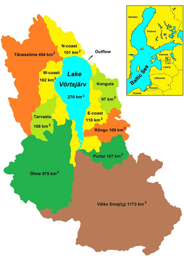
Lake Võrtsjärv is a large (270km2) and shallow (average depth 2.8m) lake located in a southern boreal forest region in southern Estonia. The lake is highly eutrophic, with high concentrations of phosphorous, nitrogen and chlorophyll a. It is dominated by planktonic primary producers, particularly cyanobacteria, which are driven by diffuse nutrient pollution from agriculture. The average water temperature rises up to 17-21°C in July. In the last decade, Lake Võrtsjärv has been covered with ice for on average 135 days each year, during the winter months. In the ice-free period it is largely turbid (cloudy) due to sediment resuspension. The lake level can vary seasonally, particularly when inflows increase following winter snow-melt. The main tributary of Lake Võrtsjärv is the River Väike Emajõgi, which flows 82km through a 1173 km2 catchment dominated by forest (51%) and agriculture (46%), and contributes around 40% of the lake’s inflow. About 35 fish species occur in Lake Võrtsjärv, with pikeperch, eel, bream and pike the most important commercial fishes, and perch and roach also abundant.
Context for modelling
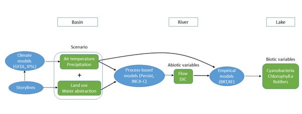
The study used a linked set of models at three scales: climate (GFDL-ESM2M and IPSL-CM5A-LR) and land use (three MARS scenarios) models at the basin scale; process-based models (Persist and INCA-C) at the river scales; and empirical models (boosted regression trees and random forests) at the lake scale. Climate (air temperature and precipitation) and land use (water abstraction) variables were downscaled to the river basin using the process-based INCA-C model, which in turn provided estimates of river flow and dissolved inorganic carbon concentrations. These outputs were then applied to the lake scale, largely using Boosted Regression Tree empirical models, which predicted three biological variables: chlorophyll a, cyanobacteria and rotifer biomass. The models contribute to a DPSIR (drivers, pressures, state, impact, response) model for Lake Võrtsjärv, in which the effects of different management interventions on ecosystem status and services (including drinking water, flood protection and recreation) is conceptualised.
Materials and methods
Data for the SWAT model was sourced from the Shuttle Radar Topography MIssion (topography), the SROA (soil types, Serviço de Reconhecimento e Ordenamento Agrário), GSE Land and Global Cover (land use) and SNIRH (Sistema Nacional de informação de Recursos hídricos) databases (weather). Two datasets were used in empirical modelling: an EU EFI+ dataset (sampled 1995-2005) was used to assess the response of fish-based functional indicators to multiple stressors; and a Portuguese Environmental Agency dataset from WFD monitoring (2010-11) was used to assess the response of biotic status indicators. The two datasets comprised 23 predictor variables, including 8 land use pressure variables (agriculture, cropland, forest, urban; in primary and upper catchment); 2 nutrient stressors (phosphorous and nitrogen), 7 hydrological stressors (relating to river flow dynamics) and 6 variables describing natural environmental variability (including weather, altitude, slope, distance from source and catchment size).
Facts and Figures: VÕRTSJÄRV
- Factors affecting measured runoff:
Tributaries experience natural variations of water level. Pollution is mostly by N and P enrichment through agriculture. - Key stakeholders:
- Estonian Environment Agency: Downscaling of storylines to Võrtsjärv basin
- Contact person: Fabien Cremona; Estonian University of Life Sciences (EMU)
Further reading
MARS Deliverables:
MARS (2017) Case study Lake Võrtsjärv - Case Study Synthesis - Deliverable 4.1. (Download report, 26.1mb)
Scientific articles and reports:
Cremona F., Kõiv T., Kisand V., Laas A., Zingel P., et al. 2014. From Bacteria to Piscivorous Fish: Estimates of Whole-Lake and Component-Specific Metabolism with an Ecosystem Approach. PLoS ONE, Vol. 9(7): e101845. DOI:10.1371/journal.pone.0101845 (Download article, 1mb)
Nõges, P. & Nõges, T. 2006. Indicators and criteria to assess ecological status of the large shallow temperate polymictic lakes Peipsi (Estonia/Russia) and Võrtsjärv (Estonia). Boreal Env. Res., Vol. 11, pp 67–80. (Download article, 612kb)
Nõges, P., Tuvikene L. & Nõges, T. 2010. Contemporary trends of temperature, nutrient loading, and water quality in large Lakes Peipsi and Võrtsjärv, Estonia Aquatic Ecosystem Health & Management, Vol. 13, pp 143–153. DOI:10.1080/14634981003788987 (Read abstract)
Tuvikene L., Nõges T. & Nõges P. 2011. Why do phytoplankton species composition and “traditional” water quality parameters indicate different ecological status of a large shallow lake? Hydrobiologia, Vol. 660, pp 3–15. DOI: 10.1007/s10750-010-0414-5 (Read abstract)
Websites:
Lake Võrtsjärv Foundation (External website)
