Key findings
- The status of invertebrate, fish and aquatic plant populations in the Ruhr Basin is strongly influenced by habitat availability, particularly the quality of river bed structure.
- Catchment afforestation is projected to cause valuable carbon sequestration and significant increases to the ecological status of basin water bodies.
- Multiple stressor interactions were not detected in the basin, so management should focus on individual, dominant stressors.
Water management issues
The River Ruhr flows for over 200 km through forest-dominated landscapes in the Central German Uplands to meet the River Rhine at Duisburg. Almost half of the 243 water bodies in the Ruhr Basin have poor-to-bad ecological status, according to Water Framework Directive assessments undertaken by the North Rhine-Westphalia State Environment Agency (19% of waterbodies rated bad, 24% poor). Less than 1% of the water bodies have high ecological status, whilst only 17% are rated as good and 39% as moderate.
Poor ecological status in water bodies across the Ruhr Basin is largely caused by two human pressures on the environment: physical modification of water bodies and diffuse and point source pollution.
Water bodies in urban and industrial areas of the basin such as Essen have frequently been straightened and deepened, and their banks and beds encased in concrete. The ecological connectivity and natural flows of many water bodies have been significantly reduced through the construction of barriers such as weirs and dams, whilst the operation of hydropower projects and related reservoirs has changed the hydrological characteristics of others.
Diffuse pressures of nutrients and chemicals from fertilisers and pesticides used in intensive agricultural practices in the lowland regions of the Ruhr Basin can significantly impact aquatic ecosystems, for example by causing eutrophication and harmful algal blooms. Similarly, wastewater from urban and industrial areas of the Ruhr Basin can contain a multitude of chemicals, microplastics, medicines and toxins potentially harmful to aquatic life if transmitted into water bodies.
Environmental storylines and scenarios
Every section of every water body in the Ruhr Basin is likely to be exposed to more than one stressor – a change in environmental conditions that places stress on the health and functioning of an organism, population and/or ecosystem. As such, the MARS project used computer models to untangle and better understand the effects of multiple stressor combinations – such as increased nutrient concentrations and habitat alterations – on the ecological status of water bodies in the Ruhr basin, and their capacity to provide ecosystem services to humans.
Multiple stressors affecting Ruhr Basin water bodies were modelled using data on three stressor groups and two natural factors. The human stressors were influenced by riparian land use, physical habitat quality and nutrient concentrations; and the natural factors were altitude and distance from source.
In order to make predictions about the future of Ruhr Basin water bodies, two different scenarios were modelled under the three different storylines (Techno, Consensus and Fragmented World) used by MARS to forecast potential trajectories for future European environments. In the first scenario, riparian zones – the ‘corridors’ of vegetation and native forest along the banks of water bodies that can buffer pollutants and flood run-off, stabilise river banks and provide biodiversity habitat – were lost. In the second scenario, riparian zones were restored across areas that are currently extensive agricultural land (pasture) or non-native forestry plantations.
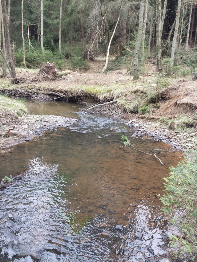
Reach 'Große Schmalenau' with typical sequence of calm pools and gravel banks with quickly-flowing water

Benthic invertebrate (Perla marginata)
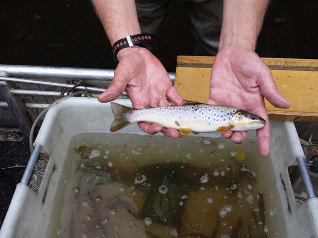
Brown trout
Results and conclusions
Multi-stressor interactions
The results of the Ruhr Basin computer modelling suggest that the three organism groups differ in their responses to multiple stressors. Of the three groups, benthic invertebrates showed the strongest relationship to human stressors and natural factors, followed by fish and macrophytes.
The status of all three organism groups was most strongly related to alterations in physical habitat quality than riparian land use and nutrient concentrations. In particular, the quality of river bed structure – e.g. pools, riffles, woody debris, substrate diversity – was a significant predictor of ecological status, largely due to habitat provision.
Stressor interactions played a minor role in the analysis of the Ruhr River Basin. Management should thus concentrate on the most dominant stressor (i.e. physical alteration of the channel bed) when devising appropriate mitigation measures to enhance ecological status.
Ecosystem services
The ecosystem service analyses for commercial fish species found that the biomass of brown trout in the Ruhr Basin was mostly explained by physical habitat quality. However, this relationship was inconsistent: worsening quality of longitudinal profile and adjacent land showed a slight positive relationship to brown trout biomass. This could be because the physical features of heavily modified water bodies – e.g. deep stream sections – provide suitable habitat for adult brown trout, whilst their extensive stocking through the system may mask human impacts.
The MARS analysis suggests that an additional 3.4 million tons CO² (35% of current total) could be sequestered from the atmosphere if riparian pasture land in the Ruhr Basin was converted to mature deciduous forest. In addition to the potential carbon storage benefit to climate change mitigation, such riparian woodland restoration may also have ecological and economic benefits. Woodland riparian zones often improve water body habitats and buffer pollutants and sediments from diffuse sources, which can help improve water quality. The study indicates that the additional carbon sequestration could have a value of €44 million on the EU emission trading market: potentially providing economic incentives to promote environmental restoration and climate change mitigation.
Scenario analysis
The results of the future scenario analyses confirm the importance of riparian deciduous woodland in improving aquatic ecological status, particularly the health of benthic invertebrate communities. Increasing naturally-forested riparian land by 50% in Consensus World lead to a projected mean improvement in ecological status of water bodies of around 22%, with around a third of analysed sites increasing a class in ecological status.
Significance for water management
Benthic invertebrates are the most suitable bioindicators for analysing multiple stressor effects in small and mid-sized mountain streams in the Ruhr Basin. However, the observed impact of multiple stressors on organisms varied depending on the specific indicator used: a variety that should be considered in water body monitoring and management.
The analyses clearly showed that stressor interactions did not play a role for the indicators investigated in this study. Therefore, water management in the Ruhr Basin should concentrate on the most dominant stressors when planning mitigation measures.
Improvements to the physical habitat quality of water bodies – particularly the diversity and quality of channel substrates (LIFE project, 2014) – is a key measure for increasing aquatic ecological status in the Ruhr Basin. Enhancing mature deciduous riparian woodland corridors beside water bodies is an important management strategy for improving ecological status and carbon sequestration. Increases in carbon sequestration in riparian zones provide an economic incentive for climate change mitigation and ecological restoration, through EU emission trading market valuations.
Basin overview
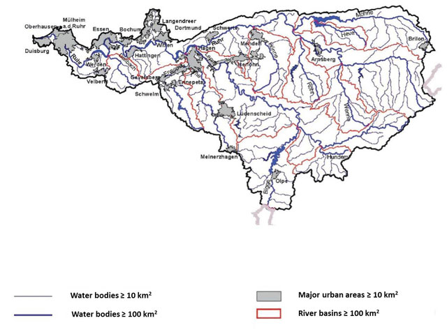
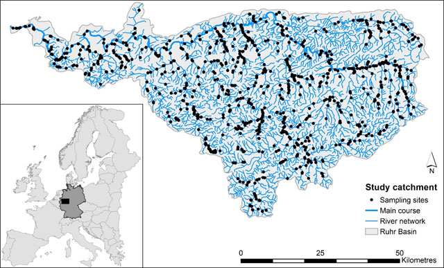
The River Ruhr flows for over 200 km through forest-dominated landscapes in the Central German Uplands to meet the River Rhine at Duisburg. The Ruhr Basin covers a surface area of 4485 km², with its southern and north-eastern parts dominated by agriculture and forestry, whereas the lower northwest is highly urbanised and industrialised, including the cities Essen, Duisburg and Bochum.
Context for modelling
Statistical techniques (Boosted Regression Trees) were used to model every possible combination of organism groups and response variables with the different stressors. This allowed the MARS team to observe the relative influence of both individual and combined stressors on ecological responses. Relevant stressors could be identified and potential interactions among individual stressors could be determined. This provided important information for appropriate river basin management measures.
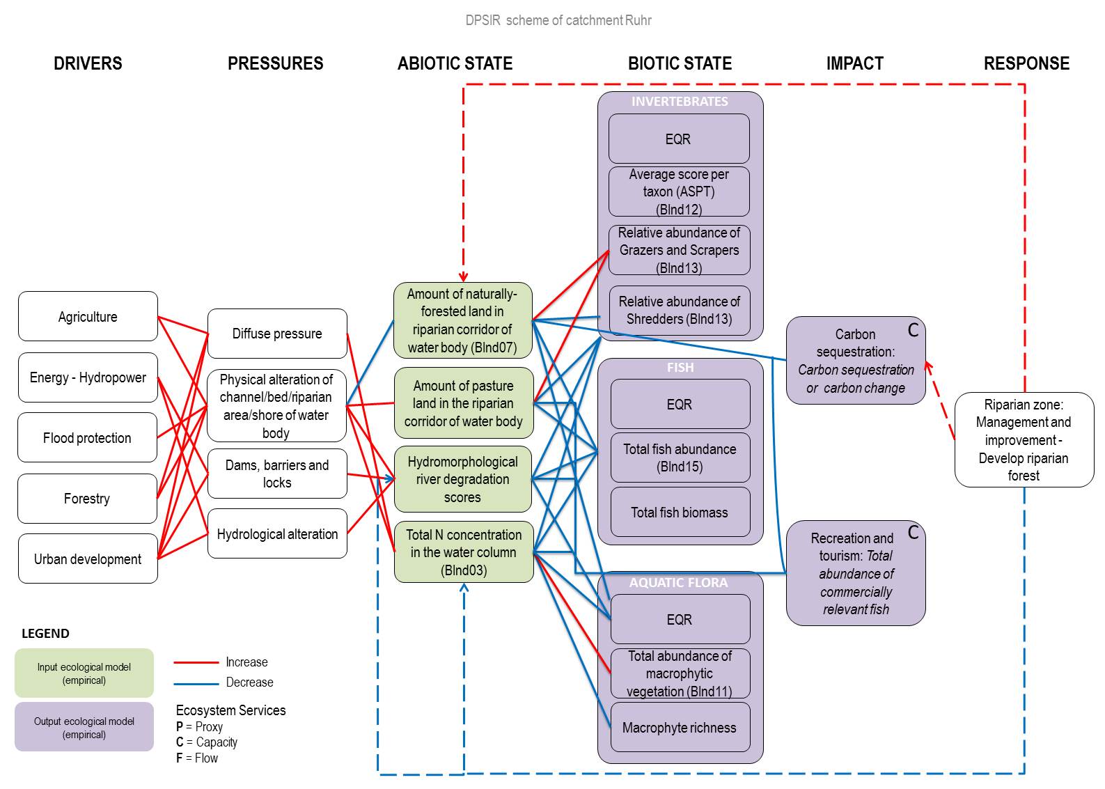
The impacts of different stressors on ecosystem service provision was modelled using the same approach. Total biomass of a commercial fish species - the brown trout - was used as an indicator for leisure fishing services; whilst total carbon stored in the riparian zone – estimated using the capacity of different land cover types – was used as an indicator for carbon sequestration services. These impacts and management responses are incorporated into the DPSIR model (Drivers, Pressures, State, Impacts, Responses) for the Ruhr Basin.
Materials and methods
To model the impacts of multiple stressors on Ruhr Basin ecosystems, the MARS team used ecological data on three organism groups – benthic invertebrates (aquatic insects), macrophytes (aquatic plants) and fish - as 'bioindicators'. This data was collected in national Water Framework Directive monitoring and by the Ruhrverband. The data used differs for each organism group – e.g. invertebrate species abundance, macrophyte species richness, total fish biomass – but provides potential ‘response variables’ for ecological change under multiple stress. Anthropogenic stressors were modelled using data on land use (ATKIS®-Basis-DLM), hydromorphology (German river habitat survey method) and nutrient inputs (Water Framework Directive monitoring). In addition, two 'natural predictors' - altitude, and distance from source - were incorporated.
Facts and Figures: RUHR
- Factors affecting measured runoff:
The Ruhr Basin is located largely in the Rhenish Massif, meaning that many of its water bodies are small to mid-sized mountain streams and rivers running through slate and schist bedrock and influenced by a largely cloudy and wet climate and land use dominated by forestry and agriculture. The north-western area of the basin is highly urbanised and industrialised, with major urban areas such as Duisburg and Essen where water bodies are frequently highly modified. - Contact person: Alexander Gieswein, University Essen-Duisburg
Further reading
MARS Deliverables:
MARS (2017). Case study Ruhr - Case Study Synthesis - Deliverable 4.1. (Download report, 26.1mb)
Scientific articles and reports:
LIFE (2014). LIFE Project „Stream valleys in the Arnsberg Forest” (Download report, 8.5mb)
Ruhrverband (2013). Ruhrwassermenge 2012 (Download report, 3.7mb)
